Cities Made of Boundaries
Mapping Social Life in Urban Form
Benjamin N. Vis (Author)
Cities Made of Boundaries presents the theoretical foundation and concepts for a new social scientific urban morphological mapping method, Boundary Line Type (BLT) Mapping. Its vantage is a plea to establish a frame of reference for radically comparative urban studies positioned between geography and archaeology. Based in multidisciplinary social and spatial theory, a critical realist understanding of the boundaries that compose built space is operationalised by a mapping practice utilising Geographical Information Systems (GIS).
Benjamin N. Vis gives a precise account of how BLT Mapping can be applied to detailed historical, reconstructed, contemporary, and archaeological urban plans, exemplified by sixteenth- to twenty-first century Winchester (UK) and Classic Maya Chunchucmil (Mexico). This account demonstrates how the functional and experiential difference between compact western and tropical dispersed cities can be explored.
The methodological development of Cities Made of Boundaries will appeal to readers interested in the comparative social analysis of built environments, and those seeking to expand the evidence-base of design options to structure urban life and development.
Supplementary materials for this book are available to download from [http://discovery.ucl.ac.uk/10055955/6/Supplement-BLT-table.pdf][1]
Related titles

Toby Butler, Felix Driver, Barbara Brayshay, Chris Church, Jeremy Iles, Oli Mould, Saskia Papadakis,
01 November 2026
Hosts, Hospitals and Hospitalities
Susana Araújo, Catarina Nunes de Almeida, Santiago Pérez Isasi,
27 July 2026
Prosperity in the Twenty-First Century
Henrietta L. Moore, Matthew Davies, Nikolay Mintchev, Saffron Woodcraft,
22 June 2023

Poetics and Politics of Islamic Imaginaries
Sertaç Sehlikoglu, Fatemeh Sadeghi, Sumrin Kalia, Erol Saglam, Alexander Pymm,
01 October 2026

Evaluating Anti-Trafficking Interventions
Ella Cockbain, Aiden Sidebottom, Sheldon X. Zhang,
18 November 2025


Creating a Framework for Developing Sessional Teachers in Higher Education
Neil Sutherland, Alex Standen,
24 August 2026
Bringing Powerful Knowledge into Classrooms
Mark Hardman, Marie Nilsberth, Mikko Puustinen,
02 July 2026
Franziska Arnold-Dwyer, Mark Dsouza, Jeevan Hariharan, Maria Lee,
01 November 2026
How Alex Bloom Built Radical Democratic Secondary Education in Post-war London
Michael Fielding, Mark Erickson,
15 September 2026
Nolwenn Bühler, Nils Graber, Victoria Boydell, Cinzia Greco,
04 December 2025
Translation Studies before ‘Translation Studies’
Kathryn Batchelor, Iryna Odrekhivska,
15 January 2026
Literary Translation in Latin America in the Twenty-First Century
Dirce Waltrick do Amarante, Letícia Maria Vieira de Souza Goellner,
04 June 2026

Inclusion, Diversity and Innovation in Translation Education
Alejandro Bolaños García-Escribano, Mazal Oaknín, Olga Castro,
01 October 2024
Contemporary Afro-Brazilian Short Fiction
Ana Cláudia Suriani da Silva, Julio Ludemir, Maria Aparecida Andrade Salgueiro,
03 September 2024
Júlia Lopes de Almeida, Ana Cláudia Suriani da Silva, Cintia Kozonoi Vezzani, Jason Rhys Parry,
17 July 2023

The Correspondence of Jeremy Bentham, Volume 14
Philip Schofield, Tim Causer, Chris Riley,
07 May 2026
Urban Transformations in Sierra Leone
Joseph M. Macarthy, Braima Koroma, Andrea Rigon, Alexandre Apsan Frediani, Andrea Klingel,
05 December 2024
Urban Violence and Marginalised Communities
Ashvin Devasundaram, Stamatis Zografos, Márcio Mattos, Zoe Holman,
25 March 2026
Family Life in the Time of COVID
Katherine Twamley, Humera Iqbal, Charlotte Faircloth,
31 August 2023
Imperial Science, the Organic Movement and the Path to Shangri-La, 1900-1969
Ashok Malhotra,
23 March 2026
Co-production of Knowledge in Action
Cassidy Johnson, Vanesa Castán Broto, Wilbard Kombe, Catalina Ortiz, Barbara Lipietz, Emmanuel Osuteye, Caren Levy,
15 September 2025

Sarah Bell, Charlotte Johnson, Kat Austen, Gemma Moore, Tse-Hui Teh,
27 April 2023

Urban Informality and the Built Environment
Nerea Amorós Elorduy, Nikhilesh Sinha, Colin Marx,
12 March 2024

Repurposing the Green Belt in the 21st Century
Peter Bishop, Alona Martinez Perez, Rob Roggema, Lesley Williams,
09 November 2020
Medical Humanity and Inhumanity in the German-Speaking World
Mererid Puw Davies, Sonu Shamdasani,
15 April 2020
The Ambivalence of Power in the Twenty-First Century Economy
Vadim Radaev, Zoya Kotelnikova,
07 July 2022
Captioning and Subtitling for d/Deaf and Hard of Hearing Audiences
Soledad Zárate, Soledad Zárate,
14 January 2021
Alex Ungprateeb Flynn, María Iñigo Clavo, Beatriz Lemos, Florencia Portocarrero,
20 May 2026
Adrienne Evans, Jamie Hakim, Jessica Ringrose, Amy Shields Dobson, Shaka McGlotten,
16 March 2026
Critical Heritage and Social Justice
Veysel Apaydin, Kalliopi Fouseki, David Francis, Jonathan Gardner, Sara Perry,
05 March 2026
Clive Young, Nataša Perović, Leo Havemann, Karen Shackleford-Cesare,
14 April 2026
Fernando Cabo Aseguinolaza, Fernando Cabo Aseguinolaza, Tomás Espino Barrera, Tomás Espino Barrera,
06 October 2025

Anneleen Masschelein, Florian Mussgnug, Jennifer Rushworth,
25 November 2021
Comparative Perspectives on the Rise of the Brazilian Novel
Ana Cláudia Suriani da Silva, Sandra Guardini Vasconcelos,
14 May 2020
Creative Critical Interventions for Social Justice
Natasha Tanna, Abeyamí Ortega Domínguez, Hakan Sandal-Wilson,
04 February 2026
Preeti Kumari, Shreya Mehta, Anjali Nair, Anusuya Nayak, Yangchen Roy, Vyom Sharma,
16 February 2026
A History of Scientific Journals
Aileen Fyfe, Noah Moxham, Julie McDougall-Waters, Camilla Mørk Røstvik,
03 October 2022
Panopticon versus New South Wales and other writings on Australia
Tim Causer, Philip Schofield, Jeremy Bentham,
24 February 2022
The Faces of Authoritarianism and Strategies of Dissent in Contemporary Brazil
Andreza Aruska de Souza Santos, Katerina Hatzikidi,
15 May 2025
The Correspondence of Jeremy Bentham, Volume 13
Philip Schofield, Tim Causer, Chris Riley, Jeremy Bentham,
11 April 2024
Rachel Rosen, Elaine Chase, Sarah Crafter, Valentina Glockner, Sayani Mitra,
09 January 2023
Online and Distance Education for a Connected World
Linda Amrane-Cooper, David Baume, Stephen Brown, Stylianos Hatzipanagos, Philip Powell, Sarah Sherman, Alan Tait,
27 March 2023
Alexander Mullan, Riley Smallman, Herre de Bondt, Juliette Waterman,
13 May 2025
Expanding Fields of Architectural Discourse and Practice
Matthew Butcher, Megan O'Shea,
27 November 2020
Generalism in Clinical Practice and Education
Sophie Park, Kay Leedham-Green, John Launer,
25 July 2024
Ethnographic Experiments with Artists, Designers and Boundary Objects
Francisco Martínez,
01 November 2021
Jennie Gamlin, Sahra Gibbon, Paola M. Sesia, Lina Berrío,
12 March 2020
Daniel Miller, Laila Abed Rabho, Patrick Awondo, Maya de Vries, Marília Duque, Pauline Garvey, Laura Haapio-Kirk, Charlotte Hawkins, Alfonso Otaegui, Shireen Walton, Xinyuan Wang,
28 July 2022
Daniel Miller, Laila Abed Rabho, Patrick Awondo, Maya de Vries, Marília Duque, Pauline Garvey, Laura Haapio-Kirk, Charlotte Hawkins, Alfonso Otaegui, Shireen Walton, Xinyuan Wang, شريف نورهان, فاضل هبة,
20 March 2022
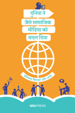
दुनिया ने जैसे सामाजिक मीडिया को बदल दिया
Daniel Miller, Elisabetta Costa, Nell Haynes, Tom McDonald, Razvan Nicolescu, Jolynna Sinanan, Juliano Spyer, Shriram Venkatraman, Xinyuan Wang,
28 February 2019
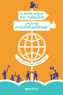
உலகம் சமூக ஊடகங்களை எப்படி மாற்றியிருக்கிறது
Elisabetta Costa, Nell Haynes, Tom McDonald, Razvan Nicolescu, Jolynna Sinanan, Juliano Spyer, Shriram Venkatraman, Xinyuan Wang,
28 February 2019
Women in the History of Science
Hannah Wills, Sadie Harrison, Erika Jones, Rebecca Martin, Farrah Lawrence-Mackey,
06 March 2023
Michael Hennessy Picard, Albert Brenchat-Aguilar, Timothy Carroll, Jane Gilbert, Nicola Miller,
03 July 2023

Urban Claims and the Right to the City
Julian Walker, Marcos Bau Carvalho, Ilinca Diaconescu,
16 March 2020
Magdalena Buchczyk, Martín Fonck, Tomás J. Usón, Tina Palaić,
24 November 2025
Towards a Global Core Value System in Doctoral Education
Maresi Nerad, David Bogle, Ulrike Kohl, Conor O’Carroll, Christian Peters, Beate Scholz,
27 September 2022
Textbook of Plastic and Reconstructive Surgery
Deepak K. Kalaskar B.Tech PhD, Professor Peter E. Butler MD, FRCSI, FRCS, FRCS (Plast), Professor of Plastic and Reconstructive Surgery, UCL, Shadi Ghali,
02 August 2016
The Tenacity of the Couple-Norm
Sasha Roseneil, Isabel Crowhurst, Tone Hellesund, Ana Cristina Santos, Mariya Stoilova,
05 November 2020
Studying Diversity, Migration and Urban Multiculture
Mette Louise Berg, Magdalena Nowicka,
02 July 2019
Claire Cameron, Alison Koslowski, Alison Lamont, Peter Moss,
06 November 2023
Schooling for Refugee Children
Eleanore Hargreaves, Brian Lally, Bassel Akar, Jumana Al-Waeli, Jasmine Costello,
07 May 2024
Charlotte Al-Khalili, Narges Ansari, Myriam Lamrani, Kaya Uzel,
02 May 2023
Rethinking the Andes–Amazonia Divide
Adrian J. Pearce, David G. Beresford-Jones, Paul Heggarty,
21 October 2020
Rethinking Urban Risk and Resettlement in the Global South
Cassidy Johnson, Garima Jain, Allan Lavell,
10 June 2021
Angela Bartie, Linda Fleming, Mark Freeman, Alexander Hutton, Paul Readman,
17 August 2020
The Responsibility of Intellectuals
Nicholas Allott, Chris Knight, Neil Smith, Noam Chomsky,
03 September 2019

Reading Randomised Controlled Trials
Robert Savage, Amy Fox, Anneka Dawson, Helen Gray, Clare Huxley,
03 March 2025

Nick Gallent, Menelaos Gkartzios, Mark Scott, Andrew Purves,
06 February 2025
Paul Vincent MA, MTA FCIoL, Honorary Senior Lecturer, Department of Dutch, UCL,
14 November 2016
O Smartphone Global: Uma tecnologia para além dos jovens
Daniel Miller, Laila Abed Rabho, Patrick Awondo, Maya de Vries, Marília Duque, Pauline Garvey, Laura Haapio-Kirk, Charlotte Hawkins, Alfonso Otaegui, Shireen Walton, Xinyuan Wang, Cecília Elisabeth Barbosa Soares,
25 February 2022
On Making in the Digital Humanities
Julianne Nyhan, Geoffrey Rockwell, Stéfan Sinclair, Alexandra Ortolja-Baird,
13 March 2023

New Directions in Private Law Theory
Fabiana Bettini, Martin Fischer, Charles Mitchell, Prince Saprai,
16 October 2023
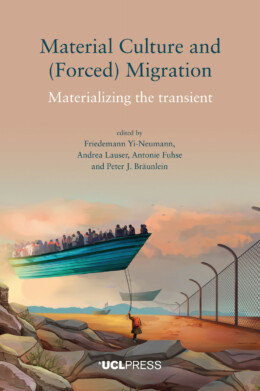
Material Culture and (Forced) Migration
Friedemann Yi-Neumann, Andrea Lauser, Antonie Fuhse, Peter J. Bräunlein,
17 February 2022
Marriage in Past, Present and Future Tense
Janet Carsten, Hsiao-Chiao Chiu, Siobhan Magee, Eirini Papadaki, Koreen M. Reece,
01 September 2021
Lo Smartphone Globale: Non solo una tecnologia per giovani
Daniel Miller, Laila Abed Rabho, Patrick Awondo, Maya de Vries, Marília Duque, Pauline Garvey, Laura Haapio-Kirk, Charlotte Hawkins, Alfonso Otaegui, Shireen Walton, Xinyuan Wang, Laura Liucci,
09 December 2021
Professor Christopher Tilley, Professor of Anthropology & Archaeology, UCL,
07 May 2019
Le Smartphone Global: Au-delà d’une culture jeune
Daniel Miller, Laila Abed Rabho, Patrick Awondo, Maya de Vries, Marília Duque, Pauline Garvey, Laura Haapio-Kirk, Charlotte Hawkins, Alfonso Otaegui, Shireen Walton, Xinyuan Wang, Stephanie Engola,
10 February 2022
Knowledge, Policy and Practice in Education and the Struggle for Social Justice
Andrew Brown, Emma Wisby,
01 April 2020
An Introduction to Waste Management and Circular Economy
Stijn van Ewijk, Julia Stegemann,
05 December 2023
Harini Amarasuriya, Tobias Kelly, Sidharthan Maunaguru, Galina Oustinova-Stjepanovic, Jonathan Spencer,
01 September 2020
Herman Gorter, Paul Vincent MA, MTA FCIoL, Honorary Senior Lecturer, Department of Dutch, UCL,
01 October 2015
Rodney Harrison, Caitlin DeSilvey, Cornelius Holtorf, Sharon Macdonald, Nadia Bartolini, Esther Breithoff, Harald Fredheim, Antony Lyons, Sarah May, Jennie Morgan, Sefryn Penrose,
28 July 2020
Heritage Conservation and Social Engagement
Renata F. Peters, Iris L. F. den Boer, Jessica S. Johnson, Susanna Pancaldo,
08 December 2020
Daniel Miller, Laila Abed Rabho, Patrick Awondo, Maya de Vries, Marília Duque, Pauline Garvey, Laura Haapio-Kirk, Charlotte Hawkins, Alfonso Otaegui, Shireen Walton, Xinyuan Wang,
06 May 2021

Gabriel Harvey and the History of Reading
Anthony Grafton, Nicholas Popper, William H. Sherman,
08 January 2024

Exploring Materiality and Connectivity in Anthropology and Beyond
Philipp Schorch, Martin Saxer, Marlen Elders,
30 March 2020
Epidemiological Change and Chronic Disease in Sub-Saharan Africa
Megan Vaughan, Kafui Adjaye-Gbewonyo, Marissa Mika,
27 January 2021
Environment and Post-Soviet Transformation in Kazakhstan’s Aral Sea Region
William Wheeler,
25 October 2021

El Smartphone Global: Más allá de una tecnología para jóvenes
Daniel Miller, Laila Abed Rabho, Patrick Awondo, Maya de Vries, Marília Duque, Pauline Garvey, Laura Haapio-Kirk, Charlotte Hawkins, Alfonso Otaegui, Shireen Walton, Xinyuan Wang, Marcela Fuentealba, Ian Davidson,
11 November 2021
Drama, Poetry and Music in Late-Renaissance Italy
Virginia Cox, Lisa Sampson, Anna Wainwright,
08 June 2023
Critical Heritage Studies and the Futures of Europe
Rodney Harrison, Nélia Dias, Kristian Kristiansen,
24 October 2023
Critical Dialogues of Urban Governance, Development and Activism
Susannah Bunce, Nicola Livingstone, Loren March, Susan Moore, Alan Walks,
01 December 2020
Como o Mundo Mudou as Mídias Sociais
Daniel Miller, Elisabetta Costa, Nell Haynes, Tom McDonald, Razvan Nicolescu, Jolynna Sinanan, Juliano Spyer, Shriram Venkatraman, Xinyuan Wang,
14 August 2019
Come il mondo ha cambiato i social media
Daniel Miller, Elisabetta Costa, Nell Haynes, Tom McDonald, Razvan Nicolescu, Jolynna Sinanan, Juliano Spyer, Shriram Venkatraman, Xinyuan Wang, Gabriella D’Agostino, Vincenzo Matera,
24 January 2019
Clare Melhuish, Henric Benesch, Dean Sully, Ingrid Martins Holmberg,
24 May 2022
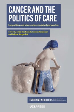
Cancer and the Politics of Care
Linda Rae Bennett, Lenore Manderson, Belinda Spagnoletti,
13 February 2023
Brian Simon and the Struggle for Education
Gary McCulloch, Antonio F. Canales, Hsiao-Yuh Ku,
21 September 2023
Belonging and Identity in STEM Higher Education
Camille Kandiko Howson, Martyn Kingsbury,
30 July 2024
An Anthropological Approach to mHealth
Charlotte Hawkins, Patrick Awondo, Daniel Miller,
28 October 2024

Ab Initio Language Teaching in British Higher Education
Ulrike Bavendiek, Silke Mentchen, Christian Mossmann, Dagmar Paulus,
01 December 2022
Daniel Miller, Laila Abed Rabho, Patrick Awondo, Maya de Vries, Marília Duque, Pauline Garvey, Laura Haapio-Kirk, Charlotte Hawkins, Alfonso Otaegui, Shireen Walton, Xinyuan Wang,
25 April 2022
Toby Butler, Felix Driver, Barbara Brayshay, Chris Church, Jeremy Iles, Oli Mould, Saskia Papadakis,
01 November 2026
Hosts, Hospitals and Hospitalities
Susana Araújo, Catarina Nunes de Almeida, Santiago Pérez Isasi,
27 July 2026
Prosperity in the Twenty-First Century
Henrietta L. Moore, Matthew Davies, Nikolay Mintchev, Saffron Woodcraft,
22 June 2023
Poetics and Politics of Islamic Imaginaries
Sertaç Sehlikoglu, Fatemeh Sadeghi, Sumrin Kalia, Erol Saglam, Alexander Pymm,
01 October 2026
Evaluating Anti-Trafficking Interventions
Ella Cockbain, Aiden Sidebottom, Sheldon X. Zhang,
18 November 2025
Creating a Framework for Developing Sessional Teachers in Higher Education
Neil Sutherland, Alex Standen,
24 August 2026
Bringing Powerful Knowledge into Classrooms
Mark Hardman, Marie Nilsberth, Mikko Puustinen,
02 July 2026
Franziska Arnold-Dwyer, Mark Dsouza, Jeevan Hariharan, Maria Lee,
01 November 2026
How Alex Bloom Built Radical Democratic Secondary Education in Post-war London
Michael Fielding, Mark Erickson,
15 September 2026
Nolwenn Bühler, Nils Graber, Victoria Boydell, Cinzia Greco,
04 December 2025
Translation Studies before ‘Translation Studies’
Kathryn Batchelor, Iryna Odrekhivska,
15 January 2026
Literary Translation in Latin America in the Twenty-First Century
Dirce Waltrick do Amarante, Letícia Maria Vieira de Souza Goellner,
04 June 2026
Inclusion, Diversity and Innovation in Translation Education
Alejandro Bolaños García-Escribano, Mazal Oaknín, Olga Castro,
01 October 2024
Contemporary Afro-Brazilian Short Fiction
Ana Cláudia Suriani da Silva, Julio Ludemir, Maria Aparecida Andrade Salgueiro,
03 September 2024
Júlia Lopes de Almeida, Ana Cláudia Suriani da Silva, Cintia Kozonoi Vezzani, Jason Rhys Parry,
17 July 2023
The Correspondence of Jeremy Bentham, Volume 14
Philip Schofield, Tim Causer, Chris Riley,
07 May 2026
Urban Transformations in Sierra Leone
Joseph M. Macarthy, Braima Koroma, Andrea Rigon, Alexandre Apsan Frediani, Andrea Klingel,
05 December 2024
Urban Violence and Marginalised Communities
Ashvin Devasundaram, Stamatis Zografos, Márcio Mattos, Zoe Holman,
25 March 2026
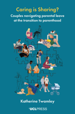
Family Life in the Time of COVID
Katherine Twamley, Humera Iqbal, Charlotte Faircloth,
31 August 2023
Imperial Science, the Organic Movement and the Path to Shangri-La, 1900-1969
Ashok Malhotra,
23 March 2026
Co-production of Knowledge in Action
Cassidy Johnson, Vanesa Castán Broto, Wilbard Kombe, Catalina Ortiz, Barbara Lipietz, Emmanuel Osuteye, Caren Levy,
15 September 2025
Sarah Bell, Charlotte Johnson, Kat Austen, Gemma Moore, Tse-Hui Teh,
27 April 2023
Urban Informality and the Built Environment
Nerea Amorós Elorduy, Nikhilesh Sinha, Colin Marx,
12 March 2024
Repurposing the Green Belt in the 21st Century
Peter Bishop, Alona Martinez Perez, Rob Roggema, Lesley Williams,
09 November 2020
Medical Humanity and Inhumanity in the German-Speaking World
Mererid Puw Davies, Sonu Shamdasani,
15 April 2020
The Ambivalence of Power in the Twenty-First Century Economy
Vadim Radaev, Zoya Kotelnikova,
07 July 2022
Captioning and Subtitling for d/Deaf and Hard of Hearing Audiences
Soledad Zárate, Soledad Zárate,
14 January 2021
Alex Ungprateeb Flynn, María Iñigo Clavo, Beatriz Lemos, Florencia Portocarrero,
20 May 2026
Adrienne Evans, Jamie Hakim, Jessica Ringrose, Amy Shields Dobson, Shaka McGlotten,
16 March 2026
Critical Heritage and Social Justice
Veysel Apaydin, Kalliopi Fouseki, David Francis, Jonathan Gardner, Sara Perry,
05 March 2026
Clive Young, Nataša Perović, Leo Havemann, Karen Shackleford-Cesare,
14 April 2026
Fernando Cabo Aseguinolaza, Fernando Cabo Aseguinolaza, Tomás Espino Barrera, Tomás Espino Barrera,
06 October 2025
Anneleen Masschelein, Florian Mussgnug, Jennifer Rushworth,
25 November 2021
Comparative Perspectives on the Rise of the Brazilian Novel
Ana Cláudia Suriani da Silva, Sandra Guardini Vasconcelos,
14 May 2020
Creative Critical Interventions for Social Justice
Natasha Tanna, Abeyamí Ortega Domínguez, Hakan Sandal-Wilson,
04 February 2026
Preeti Kumari, Shreya Mehta, Anjali Nair, Anusuya Nayak, Yangchen Roy, Vyom Sharma,
16 February 2026
A History of Scientific Journals
Aileen Fyfe, Noah Moxham, Julie McDougall-Waters, Camilla Mørk Røstvik,
03 October 2022
Panopticon versus New South Wales and other writings on Australia
Tim Causer, Philip Schofield, Jeremy Bentham,
24 February 2022
The Faces of Authoritarianism and Strategies of Dissent in Contemporary Brazil
Andreza Aruska de Souza Santos, Katerina Hatzikidi,
15 May 2025
The Correspondence of Jeremy Bentham, Volume 13
Philip Schofield, Tim Causer, Chris Riley, Jeremy Bentham,
11 April 2024
Rachel Rosen, Elaine Chase, Sarah Crafter, Valentina Glockner, Sayani Mitra,
09 January 2023
Online and Distance Education for a Connected World
Linda Amrane-Cooper, David Baume, Stephen Brown, Stylianos Hatzipanagos, Philip Powell, Sarah Sherman, Alan Tait,
27 March 2023
Alexander Mullan, Riley Smallman, Herre de Bondt, Juliette Waterman,
13 May 2025
Expanding Fields of Architectural Discourse and Practice
Matthew Butcher, Megan O'Shea,
27 November 2020
Generalism in Clinical Practice and Education
Sophie Park, Kay Leedham-Green, John Launer,
25 July 2024
Ethnographic Experiments with Artists, Designers and Boundary Objects
Francisco Martínez,
01 November 2021
Jennie Gamlin, Sahra Gibbon, Paola M. Sesia, Lina Berrío,
12 March 2020
Daniel Miller, Laila Abed Rabho, Patrick Awondo, Maya de Vries, Marília Duque, Pauline Garvey, Laura Haapio-Kirk, Charlotte Hawkins, Alfonso Otaegui, Shireen Walton, Xinyuan Wang,
28 July 2022
Daniel Miller, Laila Abed Rabho, Patrick Awondo, Maya de Vries, Marília Duque, Pauline Garvey, Laura Haapio-Kirk, Charlotte Hawkins, Alfonso Otaegui, Shireen Walton, Xinyuan Wang, شريف نورهان, فاضل هبة,
20 March 2022
दुनिया ने जैसे सामाजिक मीडिया को बदल दिया
Daniel Miller, Elisabetta Costa, Nell Haynes, Tom McDonald, Razvan Nicolescu, Jolynna Sinanan, Juliano Spyer, Shriram Venkatraman, Xinyuan Wang,
28 February 2019
உலகம் சமூக ஊடகங்களை எப்படி மாற்றியிருக்கிறது
Elisabetta Costa, Nell Haynes, Tom McDonald, Razvan Nicolescu, Jolynna Sinanan, Juliano Spyer, Shriram Venkatraman, Xinyuan Wang,
28 February 2019
Women in the History of Science
Hannah Wills, Sadie Harrison, Erika Jones, Rebecca Martin, Farrah Lawrence-Mackey,
06 March 2023
Michael Hennessy Picard, Albert Brenchat-Aguilar, Timothy Carroll, Jane Gilbert, Nicola Miller,
03 July 2023
Urban Claims and the Right to the City
Julian Walker, Marcos Bau Carvalho, Ilinca Diaconescu,
16 March 2020
Magdalena Buchczyk, Martín Fonck, Tomás J. Usón, Tina Palaić,
24 November 2025
Towards a Global Core Value System in Doctoral Education
Maresi Nerad, David Bogle, Ulrike Kohl, Conor O’Carroll, Christian Peters, Beate Scholz,
27 September 2022
Textbook of Plastic and Reconstructive Surgery
Deepak K. Kalaskar B.Tech PhD, Professor Peter E. Butler MD, FRCSI, FRCS, FRCS (Plast), Professor of Plastic and Reconstructive Surgery, UCL, Shadi Ghali,
02 August 2016
The Tenacity of the Couple-Norm
Sasha Roseneil, Isabel Crowhurst, Tone Hellesund, Ana Cristina Santos, Mariya Stoilova,
05 November 2020
Studying Diversity, Migration and Urban Multiculture
Mette Louise Berg, Magdalena Nowicka,
02 July 2019
Claire Cameron, Alison Koslowski, Alison Lamont, Peter Moss,
06 November 2023
Schooling for Refugee Children
Eleanore Hargreaves, Brian Lally, Bassel Akar, Jumana Al-Waeli, Jasmine Costello,
07 May 2024
Charlotte Al-Khalili, Narges Ansari, Myriam Lamrani, Kaya Uzel,
02 May 2023
Rethinking the Andes–Amazonia Divide
Adrian J. Pearce, David G. Beresford-Jones, Paul Heggarty,
21 October 2020
Rethinking Urban Risk and Resettlement in the Global South
Cassidy Johnson, Garima Jain, Allan Lavell,
10 June 2021
Angela Bartie, Linda Fleming, Mark Freeman, Alexander Hutton, Paul Readman,
17 August 2020
The Responsibility of Intellectuals
Nicholas Allott, Chris Knight, Neil Smith, Noam Chomsky,
03 September 2019
Reading Randomised Controlled Trials
Robert Savage, Amy Fox, Anneka Dawson, Helen Gray, Clare Huxley,
03 March 2025
Nick Gallent, Menelaos Gkartzios, Mark Scott, Andrew Purves,
06 February 2025
Paul Vincent MA, MTA FCIoL, Honorary Senior Lecturer, Department of Dutch, UCL,
14 November 2016
O Smartphone Global: Uma tecnologia para além dos jovens
Daniel Miller, Laila Abed Rabho, Patrick Awondo, Maya de Vries, Marília Duque, Pauline Garvey, Laura Haapio-Kirk, Charlotte Hawkins, Alfonso Otaegui, Shireen Walton, Xinyuan Wang, Cecília Elisabeth Barbosa Soares,
25 February 2022
On Making in the Digital Humanities
Julianne Nyhan, Geoffrey Rockwell, Stéfan Sinclair, Alexandra Ortolja-Baird,
13 March 2023
New Directions in Private Law Theory
Fabiana Bettini, Martin Fischer, Charles Mitchell, Prince Saprai,
16 October 2023
Material Culture and (Forced) Migration
Friedemann Yi-Neumann, Andrea Lauser, Antonie Fuhse, Peter J. Bräunlein,
17 February 2022
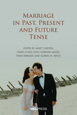
Marriage in Past, Present and Future Tense
Janet Carsten, Hsiao-Chiao Chiu, Siobhan Magee, Eirini Papadaki, Koreen M. Reece,
01 September 2021
Lo Smartphone Globale: Non solo una tecnologia per giovani
Daniel Miller, Laila Abed Rabho, Patrick Awondo, Maya de Vries, Marília Duque, Pauline Garvey, Laura Haapio-Kirk, Charlotte Hawkins, Alfonso Otaegui, Shireen Walton, Xinyuan Wang, Laura Liucci,
09 December 2021
Professor Christopher Tilley, Professor of Anthropology & Archaeology, UCL,
07 May 2019
Le Smartphone Global: Au-delà d’une culture jeune
Daniel Miller, Laila Abed Rabho, Patrick Awondo, Maya de Vries, Marília Duque, Pauline Garvey, Laura Haapio-Kirk, Charlotte Hawkins, Alfonso Otaegui, Shireen Walton, Xinyuan Wang, Stephanie Engola,
10 February 2022
Knowledge, Policy and Practice in Education and the Struggle for Social Justice
Andrew Brown, Emma Wisby,
01 April 2020
An Introduction to Waste Management and Circular Economy
Stijn van Ewijk, Julia Stegemann,
05 December 2023
Harini Amarasuriya, Tobias Kelly, Sidharthan Maunaguru, Galina Oustinova-Stjepanovic, Jonathan Spencer,
01 September 2020
Herman Gorter, Paul Vincent MA, MTA FCIoL, Honorary Senior Lecturer, Department of Dutch, UCL,
01 October 2015
Rodney Harrison, Caitlin DeSilvey, Cornelius Holtorf, Sharon Macdonald, Nadia Bartolini, Esther Breithoff, Harald Fredheim, Antony Lyons, Sarah May, Jennie Morgan, Sefryn Penrose,
28 July 2020
Heritage Conservation and Social Engagement
Renata F. Peters, Iris L. F. den Boer, Jessica S. Johnson, Susanna Pancaldo,
08 December 2020
Daniel Miller, Laila Abed Rabho, Patrick Awondo, Maya de Vries, Marília Duque, Pauline Garvey, Laura Haapio-Kirk, Charlotte Hawkins, Alfonso Otaegui, Shireen Walton, Xinyuan Wang,
06 May 2021
Gabriel Harvey and the History of Reading
Anthony Grafton, Nicholas Popper, William H. Sherman,
08 January 2024
Exploring Materiality and Connectivity in Anthropology and Beyond
Philipp Schorch, Martin Saxer, Marlen Elders,
30 March 2020
Epidemiological Change and Chronic Disease in Sub-Saharan Africa
Megan Vaughan, Kafui Adjaye-Gbewonyo, Marissa Mika,
27 January 2021
Environment and Post-Soviet Transformation in Kazakhstan’s Aral Sea Region
William Wheeler,
25 October 2021
El Smartphone Global: Más allá de una tecnología para jóvenes
Daniel Miller, Laila Abed Rabho, Patrick Awondo, Maya de Vries, Marília Duque, Pauline Garvey, Laura Haapio-Kirk, Charlotte Hawkins, Alfonso Otaegui, Shireen Walton, Xinyuan Wang, Marcela Fuentealba, Ian Davidson,
11 November 2021
Drama, Poetry and Music in Late-Renaissance Italy
Virginia Cox, Lisa Sampson, Anna Wainwright,
08 June 2023
Critical Heritage Studies and the Futures of Europe
Rodney Harrison, Nélia Dias, Kristian Kristiansen,
24 October 2023
Critical Dialogues of Urban Governance, Development and Activism
Susannah Bunce, Nicola Livingstone, Loren March, Susan Moore, Alan Walks,
01 December 2020
Como o Mundo Mudou as Mídias Sociais
Daniel Miller, Elisabetta Costa, Nell Haynes, Tom McDonald, Razvan Nicolescu, Jolynna Sinanan, Juliano Spyer, Shriram Venkatraman, Xinyuan Wang,
14 August 2019
Come il mondo ha cambiato i social media
Daniel Miller, Elisabetta Costa, Nell Haynes, Tom McDonald, Razvan Nicolescu, Jolynna Sinanan, Juliano Spyer, Shriram Venkatraman, Xinyuan Wang, Gabriella D’Agostino, Vincenzo Matera,
24 January 2019
Clare Melhuish, Henric Benesch, Dean Sully, Ingrid Martins Holmberg,
24 May 2022
Cancer and the Politics of Care
Linda Rae Bennett, Lenore Manderson, Belinda Spagnoletti,
13 February 2023
Brian Simon and the Struggle for Education
Gary McCulloch, Antonio F. Canales, Hsiao-Yuh Ku,
21 September 2023
Belonging and Identity in STEM Higher Education
Camille Kandiko Howson, Martyn Kingsbury,
30 July 2024
An Anthropological Approach to mHealth
Charlotte Hawkins, Patrick Awondo, Daniel Miller,
28 October 2024
Ab Initio Language Teaching in British Higher Education
Ulrike Bavendiek, Silke Mentchen, Christian Mossmann, Dagmar Paulus,
01 December 2022
Daniel Miller, Laila Abed Rabho, Patrick Awondo, Maya de Vries, Marília Duque, Pauline Garvey, Laura Haapio-Kirk, Charlotte Hawkins, Alfonso Otaegui, Shireen Walton, Xinyuan Wang,
25 April 2022
Cities Made of Boundaries
Mapping Social Life in Urban Form
Cities Made of Boundaries presents the theoretical foundation and concepts for a new social scientific urban morphological mapping method, Boundary Line Type (BLT) Mapping. Its vantage is a plea to establish a frame of reference for radically comparative urban studies positioned between geography and archaeology. Based in multidisciplinary social and spatial theory, a critical realist understanding of the boundaries that compose built space is operationalised by a mapping practice utilising Geographical Information Systems (GIS).
Benjamin N. Vis gives a precise account of how BLT Mapping can be applied to detailed historical, reconstructed, contemporary, and archaeological urban plans, exemplified by sixteenth- to twenty-first century Winchester (UK) and Classic Maya Chunchucmil (Mexico). This account demonstrates how the functional and experiential difference between compact western and tropical dispersed cities can be explored.
The methodological development of Cities Made of Boundaries will appeal to readers interested in the comparative social analysis of built environments, and those seeking to expand the evidence-base of design options to structure urban life and development.
Supplementary materials for this book are available to download from [http://discovery.ucl.ac.uk/10055955/6/Supplement-BLT-table.pdf][1]
‘A deep analysis on how the study of different types of boundaries can contribute to enrich urban analysis.’
ZARCH
ZARCH
‘A useful volume.’
Urban Morphology
‘[A] bold new approach to computerized spatial analysis of urban form.’
American Antiquity